Museum of 3D Relief Maps
Hôtel national des Invalides, 129 rue de Grenelle, Paris, France
Contact information
- Phone
- +33 1 45 51 92 45
- Contact us
- Website
- Visit our homepage
- Social media
-


Opening hours
- Monday
- Tuesday
- Wednesday
- Thursday
- Friday
- Saturday
- Sunday
Admission
- General
- 9.5 €
- Reduced
- 7.5 €
- Youth
- Free
- Unemployed
- Free
- Disabled
- Free
- Military
- Free
Museums nearby
- Army Museum
- 88 m
- Army Museum
- 88 m
- Museum Rodin
- 133 m
- Musée Auguste Rodin
- 146 m
- Musée de l'Ordre de la Libération
- 237 m


Museum of 3D Relief Maps
Musée des Plans-Reliefs
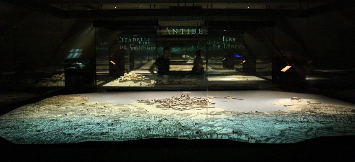
The Musée des Plans-Reliefs is a brilliantly eccentric museum devoted to an intricate and largely forgotten craft.
Created in 1943, the Musée des Plans-Reliefs houses around 100 models of French and foreign towns of strategic importance.
In 1668, under the instruction of Louis XIV, a minister created a relief-map, that is, a three dimensional map of a French fortress, in order to give military commanders a better idea of the particular castle. This saw the start of a great collection of these models, which was to become richer each year for more than two centuries.
The king’s engineers built relief-maps of all the fortresses the military was, or might be concerned with both inside and outside France. The purpose of this was not only strategic but as proof of the power of the monarchy and as commemorative works of great battles and sieges.
The Musée des Plans-Reliefs collection was first kept in the Tuileries, and then moved to the Louvre in 1700. A preservation order was placed on it in 1927. The production of these relief-maps only ceased in 1870 as fortifications with bastions began to disappear and it became less militarily important to know their precise dimensions.
The collection at the Musée des Plans-Reliefs really is amazing; it is a must see for military enthusiasts and lovers of genius eccentricity. Come experience this incredible museum with the Paris Pass.
The Museum is closed: on the first Monday of each month, on 1 January, 1 May, 1 November and 25 December.
Exhibitions and events
We don't have anything to show you here.
Educational programs
We don't have anything to show you here.
Collections
We don't have anything to show you here.